EIT RawMaterials project MULSEDRO: Multi-sensor drones for geology mapping

A unique multi-sensor fixed-wing drone system that reduces the footprint of mining activities while enabling a more efficient survey for mineral exploration.
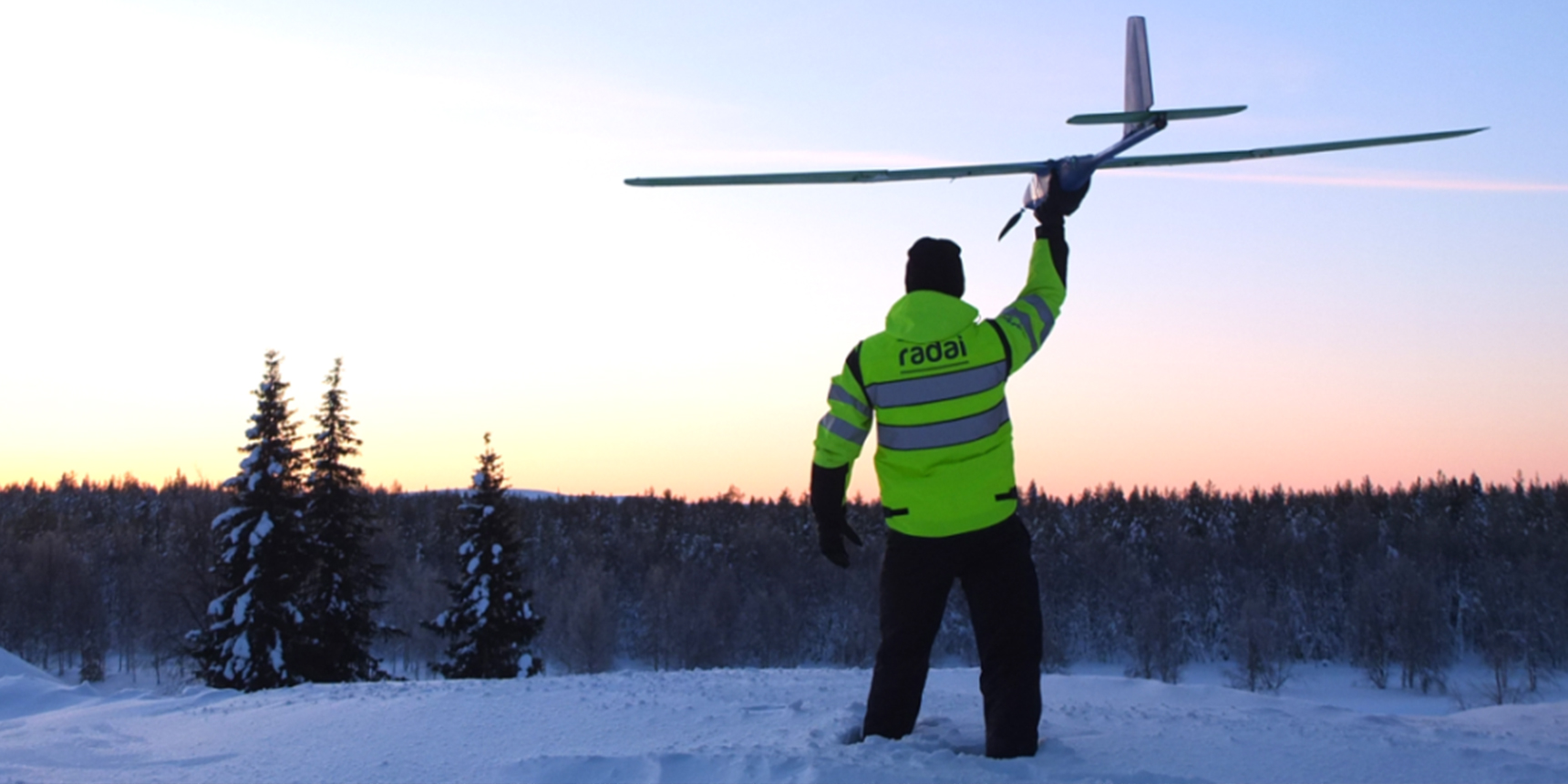
This is the fruitful result of the EIT RawMaterials project MULSEDRO: Multi-sensor drones for geology mapping. The company Radai Ltd has developed together with other partners in this upscaling project an automated system that can cover large areas in a short time. The multi-sensor drone system has proven to give reliable results under Finish winter conditions and in mountainous and arctic regions such as Greenland.
Noise disturbances are low, and the areas that can be surveyed with drones without causing any environmental harm is comparable with small conventional helicopter-borne surveys. In addition, drone surveys can be acquired at shallower altitudes and provide information in very high resolution.
PhD Björn Heincke - Project Coordinator of MULSEDRO
Radai Ltd has been able to significantly scale up its business thanks to the development of the new drone system within the project. Next to its own surveying activities, it established a rental service of the drone system for industrial partners and exploration companies that do not wish to invest in the technology but require the benefits of the technology. Hence, making it affordable and accessible to smaller exploration companies as well.
The development made in the MULSEDRO project has had a major impact on our business. Today, our drone system is presumably the only light-weight fixed-wing system that can gather simultaneously high-resolution multi-spectral and magnetic data. This data is highly relevant when characterising mineral potentials of exploration areas.
Ari Saartenoja - CEO at Radai Ltd
As part of the EIT Crisis Response Initiative, EIT RawMaterials supports Radai Ltd with Booster funding to accelerate business in the post-crisis economy. The EIT RawMaterials Booster Call in response to the COVID-19 crisis mobilised EUR 9.8 million to provide targeted support to 60 high-impact and growth potential start-ups, scale-ups and SMEs during the crisis.
Learn more about the EIT's Crisis Response Initiative
Successful upscaling thanks to supporting from EIT RawMaterials
Radai Ltd started its business in 2014 with developing a first magnetic drone system and joined the MULSEDRO project in 2017. Since then, their system has permanently improved, and their drone surveying activities for mineral exploration customer have been growing every year. Today, Radai Ltd offers magnetic surveys as a standard service for the mineral exploration industry and governmental organisations in Nordic countries, including the Arctic.
So far, we have more than 50 successful surveys for more than ten different customers. We have covered about 1 500 km2 and a total of 35 000 line kilometres. This would not have been possible without the development of the fixed-wing drone system done in the MULSEDRO project and without support from EIT RawMaterials.
Ari Saartenoja - CEO at Radai Ltd
Within the MULSEDRO project, Radai Ltd was able to extend their system by a multi-spectral camera, which allows for acquiring magnetic and remote sensing data in parallel. Such new integrated products will further increase Radai’s market size. The current number of employees is nine, and Radai Ltd has experts in geophysics, engineering and electrotechnics with many years’ experience in drone manufacturing and drone operation, data processing and software and hardware developments.
Upscaling the system to developing countries
The competitive pricing and the easily adaptable skill-set needed to fly a drone makes it attractive to also operate in developing countries by the local community and companies. Radai Ltd has started training staff at mineral exploration companies in Africa to use Radai’s drone-based surveying system themselves.
Ari Saartenoja points out that the drones are an opportunity for local communities and small companies to operate these exploration activities themselves. Consequently, this can lead to an increase in geophysical surveying for mineral exploration in general, and in particular for developing countries, where locals can increase their independency by operating the drones themselves.
New spin-off company launched in 2021
Developments within the MULSEDRO project have also had an impact on the establishment of a new spin-off company: TheiaX from the German Helmholtz Institute for Resource Technology (HZDR-HIF). TheiaX will start their business in 2021, and one of their activities will be multi-sensor drone services. In contrast to Radai Ltd, their focus will be on very high-resolution surveys on smaller targets areas with multi-copters.
In the future, cooperation between the two companies is planned to benefit from each other’s expertise. The two national Geological Surveys from Finland (GTK) and Denmark and Greenland (GEUS) joined the MULSEDRO project, and they will operate together with Radai Ltd in future scientific and surveying projects.
Partners within the MULSEDRO project were in addition to Radai Ltd, the National Geological Surveys from Finland (GTK) and Denmark and Greenland (GEUS), the German Helmholtz-Institute for Resource Technology (HZDR-HIF), the exploration technology developing company DMT GmbH & Co. KG and the business developer LTU Business AB.


 Share this page


